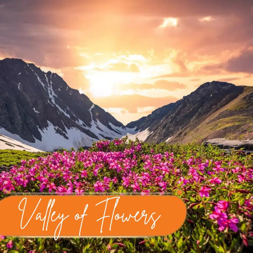
Upcoming Adventures
Valley of Flowers

July 30, 2025

Valley of Flowers
What Makes the Valley of Flowers an Unmissable Trek? True to its name, the Valley of Flowers is a breathtaking destination where vibrant blossoms blanket the landscape as far as the eye can see. This enchanting trek is famous for its lush alpine flora, showcasing more than 500 varieties of rare and colorful flowers, such as the renowned Brahma Kamal and the Himalayan Blue Poppy. A major highlight of the trek is a visit to Hemkund Sahib, one of the worlds highest Gurudwaras. This sacred site is not only spiritually significant but also offers awe-inspiring views set against a stunning mountainous backdrop. Recognized as a UNESCO World Heritage Site, the Valley is celebrated for its otherworldly beauty and pristine natural setting. Along the way, trekkers pass through charming Himalayan hamlets like Pulna and Ghangaria, the latter serving as the main base for both the Valley of Flowers and Hemkund Sahib routes. The trail offers a feast for the sensescascading waterfalls, crystal-clear streams, verdant meadows, and dramatic mountain views. The vivid hues of the valley, combined with rich wildlife and spectacular scenery, make it a paradise for nature lovers and photography enthusiasts alike. Standing amidst a sweeping floral landscape, surrounded by mist-covered peaks, feels like stepping into a dream. Open only during a limited season each year, visiting the Valley is a rare and unforgettable adventuretruly a once-in-a-year experience. Why the Valley of Flowers Stands Out Tucked away in the heart of the Himalayas, the Valley of Flowers is a rare blend of natural beauty, biodiversity, and spiritual calm. A Botanical WonderlandThis high-altitude valley bursts into color each year with hundreds of rare and exotic blooms like the Brahma Kamal, Blue Poppy, and Cobra Lily. Native flowers paint the landscape, creating a vibrant and ever-changing floral display. Wildlife in AbundanceBeyond the flowers, the valley teems with life. From elusive creatures like the red fox and musk deer to majestic birds like the Himalayan monal and great barbet, its a haven for nature and wildlife lovers. Hemkund Sahib: Peace in the PeaksA short trek away lies Hemkund Sahib, a serene Sikh pilgrimage site set beside a glacial lake and snow-covered mountains. The peaceful setting and spiritual energy make it a soul-soothing stop on your journey. A UNESCO GemDeclared a UNESCO World Heritage Site in 2002, the valleys untouched charm and unique ecosystem make it globally significant and visually unforgettable. Natures MasterpieceEvery step through the valley feels like walking through a paintingmisty peaks, flowing waterfalls, colorful meadows, and dramatic views of mountains like Nilgiri and Rataban. Its a paradise for trekkers, photographers, and anyone seeking raw, natural beauty. Is the Valley of Flowers Trek Physically Demanding? The Valley of Flowers trek is considered easy to moderate, making it suitable for both first-time and experienced trekkers. The path has gentle slopes with a few tiring stretches, especially if you're not used to walking long distances. The most strenuous part is the hike to Hemkund Sahib, which involves a steep uphill climb. Although the trail is well-paved with stone steps, the altitude and steady incline can be quite challenging. In contrast, the route to the valley passes through beautiful forested paths, which may become slippery and muddy, particularly during the monsoonso careful footing is essential. Overall, the trek isn't technically difficult, but endurance and preparation matter. Basic physical traininglike walking long distances, climbing stairs, or regular cardiodone a few weeks in advance will help you enjoy the journey with less fatigue. Is the Valley of Flowers Trek Safe? Absolutelythe Valley of Flowers trek is known to be quite safe for most travelers. The trail is well-marked and frequently used during the trekking season, so its easy to follow and doesnt pose major risks. Theres no danger from wild animals, and the route is commonly patrolled, which adds an extra layer of security. Its a great choice for first-time trekkers, families, and even solo or senior travelers, as the terrain is non-technical and doesnt involve risky climbs. You can move at your own pace, take regular breaks, and fully immerse yourself in the natural beauty around you. Spending a night in Ghangaria before heading to higher altitudes helps with acclimatization, reducing the chance of altitude-related discomfort. Staying hydrated, wearing sturdy footwear, and carrying rain protection (since its a monsoon trek) are simple but essential tips to keep your trek smooth. Every year, countless individualsincluding solo women, elderly groups, and beginnerscomplete this trek successfully. With some basic fitness, good planning, and the right gear, the Valley of Flowers is a safe and rewarding adventure for just about anyone. When Is the Best Time to Trek to the Valley of Flowers? The ideal time to explore the Valley of Flowers is between June and September. This is the period when the valley awakens from its winter slumber and transforms into a lush, colorful wonderland. As the snow melts, the flowers begin to bloom, and by mid-July, the valley reaches its peak beautyblanketed in thousands of vibrant flowers in every color imaginable. July and August are the prime months to visit, as this is when the floral display is at its fullest. The monsoon rains during this time are essentialthey nourish the valley and enhance the richness of the colors. From vivid pinks and purples to soft yellows and whites, the entire landscape resembles a natural painting. During this season, the surrounding greenery is at its most vibrant, with waterfalls cascading down cliffs and rivers flowing alongside the trails. The weather is cool and refreshing, offering a pleasant trekking experience. However, since its also monsoon season, you should be prepared for raincarry a rain jacket and waterproof covers to keep your gear dry and your trek comfortable. How Was the Valley of Flowers Discovered? The Valley of Flowers was discovered by chance in 1931 by mountaineers Frank Smythe, Eric Shipton, and R.L. Holdsworth while returning from their Mount Kamet expedition. Later, in 1980, it was declared a national park and became part of the Nanda Devi Biosphere Reserve in 2000. Today, it's recognized under UNESCOs Man and the Biosphere (MAB) program. Home to a wide variety of alpine flowerssome with medicinal valuethe valley is protected, with no grazing allowed due to the presence of endangered plant species. Along the trail, trekkers can also visit the memorial of Joan Margaret, a botanist who died while exploring the valley. In essence, trekking the Valley of Flowers is a soulful experience. With its vivid blooms, misty monsoon skies, and peaceful atmosphere, it offers a rare connection with naturean unforgettable journey worth doing at least once in a lifetime. Embark on this unforgettable trek with Oxbow Explore. Your gateway to the breathtaking Valley of Flowers.Visit www.oxbowexplore.com or email us at info@oxbowmedia.in to plan your adventure today!
read more arrow

Blogs
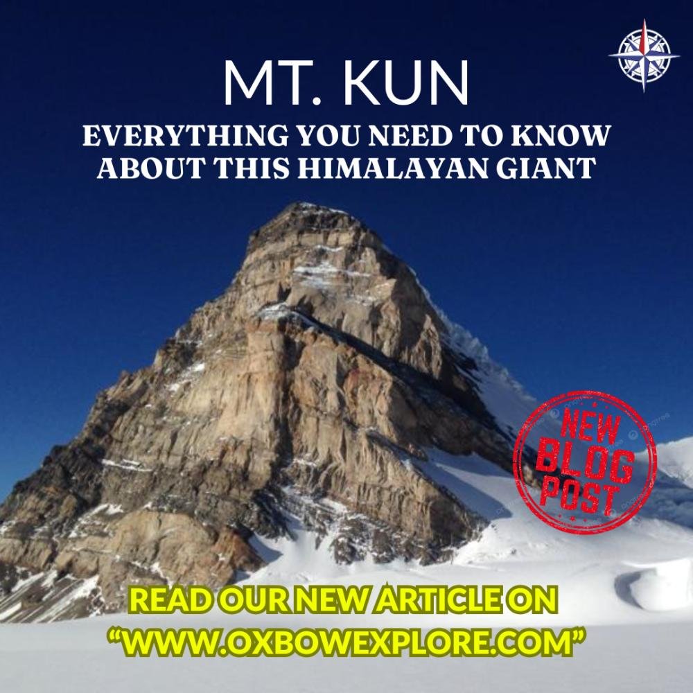
MOUNT KUN

August 17, 2026

MOUNT KUN
MOUNT KUN: EVERYTHING YOU NEED TO KNOW ABOUT THIS HIMALAYAN GIANT Some mountains challenge the climber; others challenge the imagination. Mount Kun does both. High in the rugged landscape of Ladakh, where deep valleys meet enormous walls of rock and ice, stands Mount Kunone of the remarkable high peaks of the Himalayan region. Rising to approximately 7,077 metres (23,212 feet), Kun is far more than a number on an elevation chart. It is part of a dramatic landscape shaped by glaciers, snowfields, steep ridges, and centuries of natural forces. But the story of Mount Kun becomes even more fascinating when we look beyond the summitto its neighboring peak, Mount Nun, and the spectacular NunKun massif. Where Mount Kun Begins Its Story Mount Kun is located in the Suru Valley region of Ladakh, surrounded by some of the most dramatic high-altitude landscapes in the region. The journey towards the mountain takes travelers through a world of rugged valleys, remote settlements, glaciers, and towering Himalayan peaks. As the landscape rises, the familiar world gradually disappears. The air becomes thinner, the temperatures colder, and the mountains increasingly dominate the horizon. Understanding Nun and the NunKun Massif Before understanding Kun, it is important to understand Mount Nun. Nun is the higher of the two principal peaks, while Kun stands as its neighboring summit. Together, they form the famous NunKun massif. Although Nun and Kun are closely associated, they are distinct mountains with their own geographical and mountaineering characteristics. Their presence together gives the region a unique identity. Mt. Kun vs. Mt. Nun: Which One Should You Opt For? Altitude Difference: The height difference is minimalMt. Nun stands at 7,135 m, while Mt. Kun is 7,077 m, making them only about 60 meters apart. Technical Difficulty: Both peaks demand advanced mountaineering skills, physical fitness, and strong acclimatization. Route Characteristics: Mt. Nun involves exposed ridges and a challenging summit push, while Mt. Kun has a more defined technical section between Camp 1 and Camp 2. Risk Factor: Both expeditions carry comparable high-altitude risks, which can vary with weather, snow, and route conditions. Choose Mt. Nun if you want to climb one of Indias highest peaks, enjoy exposed ridge climbing, and aim for a prestigious 7,000 m+ summit. Choose Mt. Kun if: You are looking for a technically engaging climb, want to progress toward higher-altitude expeditions, and prefer a route with a defined technical crux. Experience Required: Neither peak should be considered an easy option. Both are serious 7,000m-class expeditions and are best suited to experienced climbers with prior 6,000m+ mountaineering experience. The Legacy Behind Mount Kun Mt. Kun was successfully summited in 1953 by a Swiss-French-Indian team led by Bernard Pierre. However, the mountain was first climbed much earlier, in 1913, by an Italian expedition led by Mario Piacenza. This early ascent marked an important milestone in the history of Himalayan mountaineering. A Mountain Shaped by Rock and Ice Mount Kun rises from a landscape where rock and ice dominate the higher elevations. Glaciers, snowfields, steep ridges, and deep valleys create a constantly changing environment. From the lower valleys, the mountain can appear distant and almost unreachable. As the landscape rises towards the higher elevations, however, the scale of the mountain becomes increasingly apparent. It is this combination of rugged terrain and frozen landscapes that gives Kun much of its visual character. What Makes Mount Kun Unique? Mount Kun's uniqueness is not simply its elevation. Several characteristics come together to create its identity: High-Altitude LandscapeItselevation places it in an extreme Himalayan environment of snow, ice, and rock. Connection with Mount NunItsrelationship with Nun gives the mountain a distinctive place within the NunKun massif. Glaciers and SnowfieldsThesurrounding frozen landscape contributes to the mountain's dramatic appearance. Remote SettingItslocation in the Suru Valley adds a sense of remoteness and discovery. Mountaineering Heritage Kun has an important place in the history of high-altitude mountaineering in the region. Mount Kun and Himalayan Mountaineering For mountaineers, Mount Kun represents more than a high summit. Its elevation, steep terrain, glaciers, weather, and remote setting create an environment that demands preparation, technical ability, endurance, and respect for nature. The mountain has therefore become part of the broader story of Himalayan exploration and mountaineering. The Landscape Beyond the Summit Perhaps one of the most fascinating aspects of Mount Kun is that its story does not end at the summit. The surrounding Suru Valley, glaciers, neighbouring peaks, and remote mountain settlements create a much larger landscape to explore. Every ridge appears to lead towards another horizon, while the changing light across the mountains constantly transforms the scenery. Why Mount Kun Continues to Fascinate Mount Kun brings together several elements that make the Himalayas extraordinary: Extreme altitude Dramatic glaciers and snowfields Rugged mountain terrain Remote valleys A fascinating connection with Mount Nun A rich mountaineering heritage Together, these characteristics make Kun much more than another Himalayan peak. A Mountain Worth Discovering Mount Kun represents the spirit of Himalayan explorationthe desire to travel beyond familiar landscapes and discover what lies behind the next ridge. Its combination of natural beauty, geography, altitude, and mountaineering history continues to capture the imagination of people fascinated by the mountains. And perhaps that is what makes Kun truly remarkable. You can measure its height in meters, study its geography on a map, and describe its glaciers in wordsbut the full character of the mountain can only be understood by experiencing the vast landscape that surrounds it. More Than Just a Mountain Mount Kun is not simply a 7,077-meter peak in Ladakh. It is part of a larger Himalayan storya story of rock and ice, Nun and Kun, valleys and glaciers, exploration and endurance. For those who look beyond the numbers, Mount Kun offers something even more powerful: the feeling that there is always another ridge to cross, another horizon to discover, and another Himalayan story waiting to be told.
read more arrow
HOW BORDER TOURISM IS OPENING NEW ROUTES FOR MOUNTAINEERS

January 6, 2026

HOW BORDER TOURISM IS OPENING NEW ROUTES FOR MOUNTAINEERS
The mountains have always called, but now even the borders are answering. Indias vast and diverse terrain has long attracted mountaineers, trekkers, and adventure seekers. While the Himalayas, Karakoram, and Northeast ranges are well-charted in mountaineering literature, recent years have seen a new wave of explorationone that emerges from Indias border regions. Border tourism, once a restricted concept due to security concerns, is now opening unprecedented avenues for mountaineers. From Ladakh to Arunachal Pradesh and Sikkim to Siachen, these frontier areas are revealing untouched peaks, unexplored valleys, and culturally rich landscapes. Why Border Regions Are the New Mountaineering Frontier Unexplored TerrainBorder areas often contain peaks, glaciers, and passes that are largely unmapped. Many remain untouched by commercial expeditions, offering mountaineers the ultimate challenge: a first ascent. Strategic AccessibilityIncreased security protocols, guided treks, and government initiatives are making border regions more accessible to civilian adventure enthusiasts without compromising safety. Cultural ImmersionBorder regions are home to remote communities with distinct traditions and heritage. Mountaineers now experience ethno-adventure tourism, combining physical challenge with cultural insight. Environmental AwarenessTrekking and climbing in these fragile ecosystems often emphasize sustainable tourism climbers act as ambassadors for conservation, documenting biodiversity and glacial health. Government and Private Initiatives Boosting Border Tourism Permits and Controlled AccessAgencies coordinate with the Indian Army and ITBP, providing secure access to previously restricted regions. Adventure and Eco-Tourism CollaborationState tourism boards in Ladakh, Arunachal Pradesh, and Sikkim now partner with private operators to provide treks, climbing routes, and camping experiences. Infrastructure DevelopmentBetter roads, base camps, and guided routes make border regions accessible while maintaining security and ecological balance. International Mountaineering PartnershipsCollaborative programs with mountaineering institutes like NIMAS and IMF allow enthusiasts to participate in high-altitude, low-impact expeditions. Sustainability and Responsibility Border tourism isnt just about adventure; its about ethical exploration. Climbers are encouraged to: Practice Leave No Trace principles Respect local communities and tribal traditions Participate in tree plantations, clean-up drives, and glacial documentation Sustainable border tourism ensures that these fragile ecosystems remain preserved for future mountaineers and adventurers. The Mountaineering Advantage For climbers, border tourism presents unique benefits: Unclimbed or less-frequented peaks Opportunities to attempt first ascents or unexplored routes. Skill EnhancementHigh-altitude training, glacier trekking, and navigation in extreme conditions. Cultural Enrichment Encounters with local communities, festivals, and indigenous knowledge. Scientific Contribution Recording flora, fauna, and glacial changes aids environmental research. These experiences transform mountaineering from a personal adventure into a holistic learning journey. Future of Border Mountaineering in India Integration with Adventure Tourism: Multi-day treks combining mountaineering, cultural experiences, and environmental studies. Technology-Driven Exploration: Use of drones, GPS mapping, and satellite imaging for safer and better-planned expeditions. Women-Led Expeditions: Increasing participation of female mountaineers in high-altitude border expeditions. International Collaboration: Training camps and joint expeditions with global Border tourism is redefining Indian mountaineering. It offers unexplored routes, heightened adventure, and cultural depth, combining the thrill of climbing with a sense of national pride and environmental responsibility. For mountaineers seeking the ultimate frontier, the message is clear: the summit isnt just on the peak its in the journey through Indias borders.
read more arrow
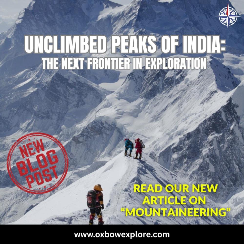
UNCLIMBED PEAKS OF INDIA: THE NEXT FRONTIER IN EXPLORATION

December 2, 2025

UNCLIMBED PEAKS OF INDIA: THE NEXT FRONTIER IN EXPLORATION
India, with its vast Himalayan expanse, rugged Karakoram ranges, and the pristine peaks of the Northeast, has long been a playground for mountaineers and adventure seekers. While famous summits like Everest, Kanchenjunga, and Nanda Devi attract climbers from around the world, a vast number of peaks in India remain untouchedthe unclimbed peaks that represent the final frontier of exploration. For the modern mountaineer, these untouched summits offer not only adrenaline and challenge but also the opportunity to rewrite history, document unexplored terrain, and connect with nature in its rawest form. Why Unclimbed Peaks Matter Unclimbed peaks are more than just a title on a mountaineers resume. They represent: Pure ExplorationUnlike popular summits, unclimbed peaks offer a blank canvas. No fixed routes, no established base camps, no guidebooks. Every step is discovery. Scientific Environmental ValueMany of these peaks are in remote, ecologically sensitive zones. Expeditions contribute to mapping, glaciology studies, biodiversity assessments, and climate research. Cultural Heritage Insights Unexplored ranges often lie near remote villages or tribal communities. Expeditions provide a glimpse into local culture and heritage, rarely documented in mainstream mountaineering narratives. Indias Most Intriguing Unclimbed Peaks 1. Gya Peak, Himachal Pradesh Height: ~6,794 m Nestled in the Lahaul-Spiti region, Gya Peak is surrounded by remote valleys and glacial terrain. Its accessibility is challenging, requiring multiple days of trekking just to reach the base. Potential: Perfect for high-altitude acclimatization expeditions and alpine-style climbs. 2. Gorichen West, Arunachal Pradesh Height: 6,538 m Located in the easternmost frontier, Gorichen West remains unconquered due to restricted access and extreme weather patterns. Significance: The peak is considered sacred by local tribes, offering cultural insights along with the challenge of isolation and extreme conditions. 3. Saltoro Kangri II East, Siachen Region Height: 7,400+ m A technically demanding peak in the politically sensitive Siachen region, climbers face not only steep ice walls but also logistical and security hurdles. Adventure Factor: Extremely high, with very few expeditions allowed by the Indian Army. 4. Namcha Barwas Adjacent Unclimbed Summits, Arunachal Pradesh Namcha Barwa itself is partially explored; its adjacent peaks remain untouched due to heavy glaciation, dense forests, and remote terrain. Why it matters: Offers a chance for alpine exploration in the eastern Himalayas, a region less frequented compared to the western Himalayas. Challenges of Climbing Unclimbed Peaks No Established RouteUnlike popular mountains, climbers must survey, scout, and plan every step. This requires advanced navigation skills. Extreme WeatherHigh-altitude storms, avalanches, and unpredictable snowfall are routine hazards. Logistics AccessRemote peaks often require weeks of trekking to reach base camps, sometimes through restricted zones requiring permits. Technical DifficultyMany unclimbed peaks have mixed rock, ice, and snow terrains with steep faces, requiring advanced mountaineering skills. Health AcclimatizationHigh-altitude sickness, crevasses, and hypothermia are constant threats. The Future of Mountaineering in India Unclimbed peaks represent the next frontier in adventure tourism and exploration. They challenge modern mountaineers to push boundaries while honoring the environment. Some emerging trends include: Integrated Expeditions: Combining mountaineering with ecotourism, cultural immersion, and community development. Technology-Assisted Exploration: Drones, GPS mapping, and satellite imagery allow safer navigation of remote peaks. Women-Led Teams: Expanding opportunities for female mountaineers to conquer uncharted territory. Scientific Collaborations: Expeditions contributing to glaciology, biodiversity, and climate research.
read more arrow
THE ANATOMY OF ENDURANCE

October 23, 2025

THE ANATOMY OF ENDURANCE
Training for the Mountains: Pre-Climb Routines That Build Endurance The summit doesnt forgive what the body forgets.Mountains reward preparationnot luck. Long before the first step on the trail, the climb begins in the quiet discipline of training. For every successful expedition, there are months (sometimes years) of pre-climb routines designed to strengthen the body, sharpen the mind, and build endurance for thin air and unforgiving terrain. This article explores what true mountain conditioning looks likehow top mountaineers prepare physically and mentally for high-altitude expeditionsand what lessons even amateur trekkers can adopt. The Anatomy of Endurance Mountaineering is a full-body sport that challenges the cardiovascular system, muscular endurance, and mental gritoften at the same time. At altitude, oxygen levels can drop to 6070% of what youre used to at sea level. That means your lungs, heart, and muscles have to work much harder to do the same work. A good pre-climb routine, therefore, focuses on Cardiovascular conditioningto improve oxygen efficiency. Muscular enduranceespecially for legs, core, and back. Mental staminato keep calm under fatigue, cold, and uncertainty. As professional mountaineer Reinhold Messner once said, You train your lungs, legs, and limitsbut the summit will still test your soul. Phase 1: Building the EngineCardio and Aerobic Base Your aerobic base is the foundation of every climb. Without it, fatigue sets in early, altitude sickness hits harder, and recovery becomes slow. 1. Long Slow Distance (LSD) Training This isnt about speedits about consistency.Engage in steady-state cardio activities like Brisk walking or hiking with a loaded backpack (1015 kg) Cycling, swimming, or running for 4590 minutes Stair climbing with incremental weight Goal: 45 cardio sessions per week, maintaining 6070% of maximum heart rate for at least an hour. Phase 2: Strength Functional Training Climbing is a test of repetitiontaking thousands of steps uphill with a heavy pack. Strength training ensures your muscles can sustain that load efficiently. 2. Focus on Compound Movements These simulate real climbing motion and build functional endurance. SquatsBuilds quads, glutes, and lower back strength. Lunges Step-Ups Mimic uphill movement patterns. Deadlifts Develop posterior chain strength (essential for load carrying). Pull-Ups PlanksStrengthen the upper body and core for balance. 3. The Stair Backpack Drill Load a backpack with 1015 kg and climb stairs for 3045 minutes. It replicates a steep mountain ascent and trains both leg muscles and cardiovascular capacity. Real-world tip: The Nehru Institute of Mountaineering (NIM) recommends trainees practice weighted stair climbs at least thrice a week, gradually increasing both load and duration. Phase 3: Mobility, Balance Core Stability Mountains are uneven, unpredictable, and punishing on joints. A climber must stay agile, not just strong. 4. Yoga Mobility Work Surya Namaskar for full-body flexibility and breath control. Dynamic stretching for hips, hamstrings, and calves. Balance drills on Bosu balls or single-leg stance for ankle stability. 5. The Breath-Body Connection At altitude, calm breathing is power.Daily practice of Pranayama, especially Anulom Vilom and Bhastrika, helps strengthen the diaphragm and increase lung capacityvital for acclimatization. Phase 4: Mental Conditioning A mountaineers biggest muscle is the mind. The ability to endure pain, isolation, and uncertainty often decides who makes it to the summit. 6. Simulate Discomfort Train early mornings in cold conditions.Practice hikes in rain or wind.Carry a pack heavier than your expedition load.When discomfort becomes familiar, fear fades. 7. Visualization Focus Elite climbers use mental imageryvisualizing every stage of the climb, from setting up camp to summiting. This reduces anxiety and builds situational control. Example: Before her Everest expedition, Bachendri Pal reportedly practiced visualization techniques daily, rehearsing crisis management in her mind. She credited this discipline with keeping her calm during storms and setbacks. 8. Fuel for the AscentNutrition Recovery Endurance training demands smart fueling. Carbohydrates power long climbs. Protein aids recovery and muscle repair. Healthy fats maintain energy in cold environments. Hydration is equally critical. Dehydration is a hidden threat at altitudeaim for at least 34 liters per day during training. Rest Recovery:Schedule rest days. Altitude punishes fatigue. Overtraining before a climb can compromise immunity and oxygen absorption. Phase 5: Simulated Mountain Conditions In the final 68 weeks before a major climb: Train at elevated terrain whenever possiblehigh-altitude treks like Triund or Kedarkantha are excellent acclimatization grounds. Practice multi-day hikes with geartents, sleeping bags, technical clothingto understand body response over consecutive days. If accessible, train with altitude masks or use stair machines to simulate oxygen deprivation (though not a full replacement for real altitude). The 3-Month Pre-Climb Blueprint (Summary) Month Focus Area Key Activities Month 1 Aerobic base + Basic strength Long-distance runs, cycling, yoga, bodyweight drills Month 2 Functional endurance + Load training Weighted hikes, stair climbs, resistance workouts Month 3 Simulation + Recovery focus Multi-day treks, mindfulness, high-protein diet, active rest The Takeaway: Training Beyond the Physical Mountaineering training is not about achieving peak fitnessits about achieving adaptive fitness. The mountain doesnt demand perfection; it demands presence, preparedness, and persistence. When you train for the mountains, you dont just strengthen your legs or lungsyou cultivate resilience, patience, and humility. You learn to pace yourself through the chaosmuch like life itself. Because in the end, training for the climb is really training for the self.
read more arrow
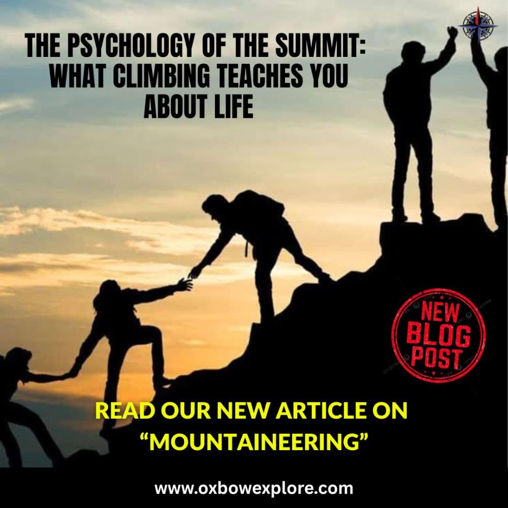
THE PSYCHOLOGY OF THE SUMMIT: WHAT CLIMBING TEACHES YOU ABOUT LIFE

October 15, 2025

THE PSYCHOLOGY OF THE SUMMIT: WHAT CLIMBING TEACHES YOU ABOUT LIFE
The summit is not just a placeits a state of mind. Theres something quietly transformative about standing on a mountain summit. The air thins, the noise of the world fades, and in that silence, the human spirit finds clarity. Mountaineering is more than a physical pursuitits a psychological journey that reveals who we truly are when the layers of comfort are stripped away. The Summit is Never Just the Top In mountaineering circles, theres a phrase often repeated: The summit is only halfway.Its a sobering reminder that the climb is as much about endurance, decision-making, and humility as it is about triumph. Consider the story of Sir Edmund Hillary and Tenzing Norgay, the first climbers to summit Everest in 1953. Their achievement wasnt just about strengthit was about resilience and presence of mind. Hillary later said that what stayed with him most wasnt the view from the top, but the realization that courage and caution must coexist. Lesson: Success is not a destinationits the balance between ambition and awareness. Discomfort Breeds Growth In the world below, comfort is often seen as success. But in the mountains, comfort is the enemy of growth. Climbers deliberately choose discomfortcold winds, sleepless nights, unpredictable weatherbecause it reveals resilience that modern life rarely tests. Take Arunima Sinha, the worlds first female amputee to climb Mount Everest. After losing a leg in a tragic accident, she turned her pain into purpose. Her climb wasnt just physical; it was an ascent of spirit. The mountain didnt test my leg, she said. It tested my will. Lesson: Pain is temporary. Purpose endures. The Mind as the True Muscle Every expedition has a point where the body wants to quit. Thats when the climb becomes psychological. Mountaineers often speak of a flow statea meditative rhythm of breath, focus, and movement that keeps them going when logic says stop. During the IMF Climbathon at Bara Shigri Glacier (2024), young mountaineers faced extreme altitude fatigue. Yet through team morale, mindfulness, and visualization techniques, they completed an ascent to an unnamed 5,700 m peak. Their success later became a case study in mental conditioning under stress used in NIMAS training. Lesson: The mind is the climbers strongest ropethe one that holds when everything else weakens. Leadership in Thin Air Mountaineering is also a masterclass in leadership and decision-making. A leader on an expedition doesnt just chart routesthey read people, sense fatigue, and make life-saving calls. The 1996 Everest disaster, immortalized in Into Thin Air, showed how overconfidence and poor judgment can turn fatal. The mountain doesnt tolerate ego it demands empathy and collective strength. Expedition leaders to peaks like Everest, Kangchenjunga often say their greatest takeaway is not authority, but listening. Lesson: Real leadership isnt about commanding. Its about caring. Every Descent is a Beginning The descent is where reflection begins. Climbers often describe a deep sense of peace after returning to base a quiet gratitude for warmth, breath, and companionship. Mountaineering, in this sense, mirrors life. You strive for years to reach your summit, only to realize the joy lies not at the top, but in the person you became on the way up. Lesson: Coming down with humility is as important as going up with determination. Case Study: The Siachen Glacier TrekWhen Civilians Climbed with Soldiers In 2023, Oxbow Explore, in collaboration with the Indian Army, organized a civilian trek to the Siachen Glacier the worlds highest battlefield. Participants, including entrepreneurs, doctors, and artists, trained alongside soldiers and trekked to forward posts. It wasnt a climb to conquer a peak, but a journey to understand endurance, teamwork, and service. One participant reflected, At 16,000 feet, surrounded by men who live here year-round, you stop asking why me?youstart asking how can I do more? Lesson: The summit gives perspectiveit changes how you see yourself, your challenges, and your purpose. Life Lessons from the Mountains Resilience is learned. Each step through hardship rewires your mind for strength. Humility sustains success. The mountain always has the last word. Purpose outlasts pain. Climb for meaning, not ego. Connection creates power. No summit is reached alone. Reflection completes achievement. The journey matters as much as the peak. The Mountain Within Every person has a mountaina dream, a fear, or a challenge that looms large.Mountaineering teaches us that climbing isnt about conquering nature but about mastering ourselves. Whether youre scaling a 6,000-meter peak or navigating the quiet climbs of everyday lifekeep moving, stay aware, and respect the climb. Because the real summit isnt in the clouds.Its in the mind.
read more arrow
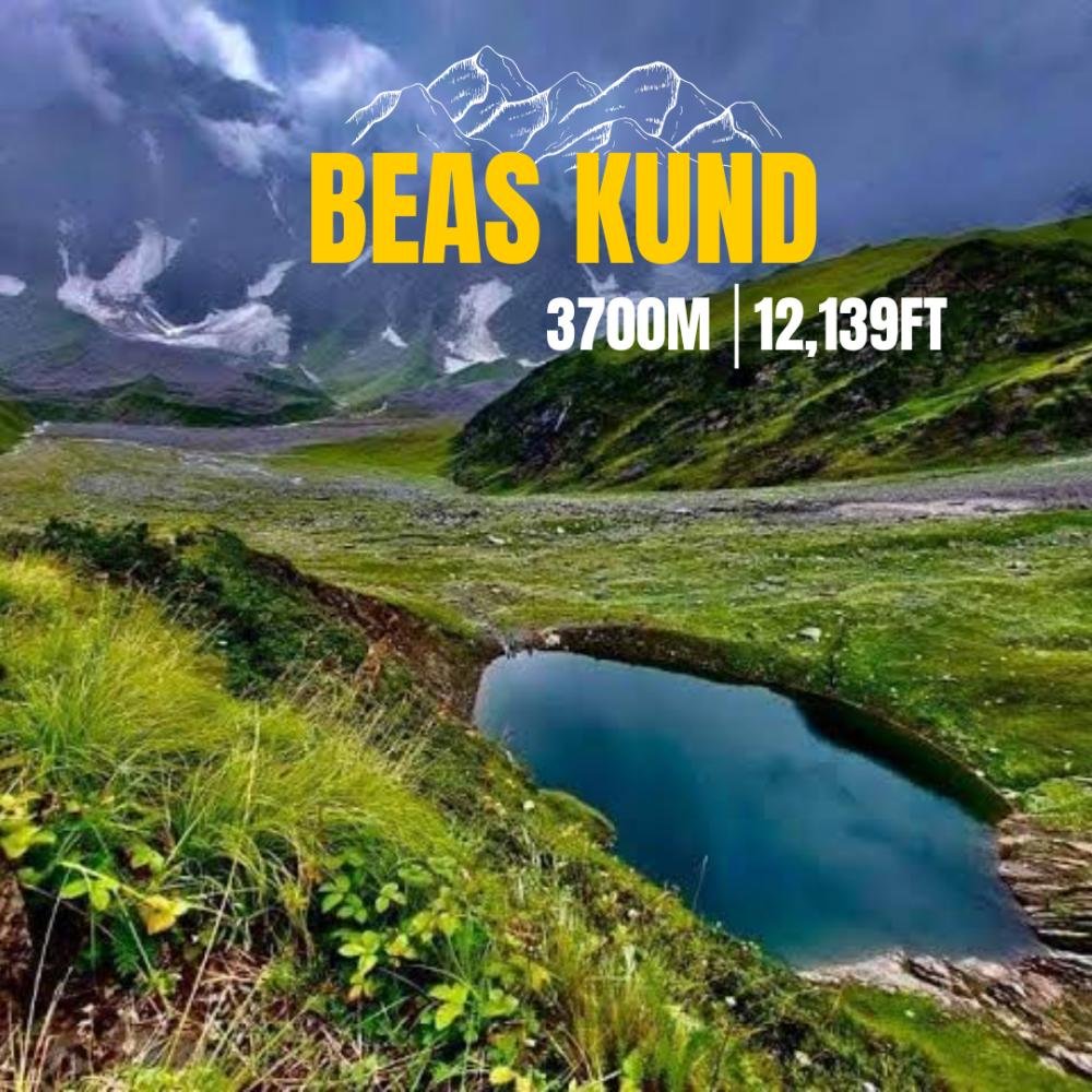
Beas Kund

July 30, 2025

Beas Kund
Beas Kund Beas Kund, at 12,200 ft, offers a scenic and easy trek ideal for beginners, experienced trekkers, and families. Best done in summer, the trail passes lush meadows and wildflowers, ending at the emerald lake. Enjoy camping in nature and stargazing under clear skies. Why Should You Trek to Beas Kund? The Beas Kund Trek, located near Manali in Himachal Pradesh, is a must-do for nature and adventure lovers, especially beginners. This scenic trek leads to the source of the Beas River, which flows through Manali. Nestled amidst the Pir Panjal ranges, Beas Kund is surrounded by stunning landscapes, with snow-capped peaks, lush greenery, and crystal-clear streams that eventually join the Beas River. The breathtaking views make the area feel like something out of a fairytale. Adding to its charm, local legend says that the sage Maharishi Vyas, author of the Mahabharata, used to bathe in this lakehence the name Beas Kund. Main Highlights of the Beas Kund Trek Stunning Mountain ViewsOn the Beas Kund Trek, youll get to see some of the most beautiful Himalayan peaks. Tall mountains like Friendship Peak, Hanuman Tibba, and Shitidhar stand covered in snow and look amazing. On clear days, you might also spot Deo Tibba, Indrasen, and parts of the Pir Panjal Range. Beautiful ForestsAt the start of the trek, youll walk through thick forests filled with tall Deodar (cedar) trees. These trees feel ancient and give a peaceful, magical feeling to the trail. Beas Kund LakeThe main attraction of the trek is Beas Kund, the lake where the Beas River begins. Surrounded by high mountains, the lake is not only important geographically but also incredibly beautifula perfect reward at the end of your trek. Embark on this unforgettable journey with Oxbow Explore.Visit www.oxbowexplore.com or reach out to us at info@oxbowmedia.in to start planning your adventure today!
read more arrow
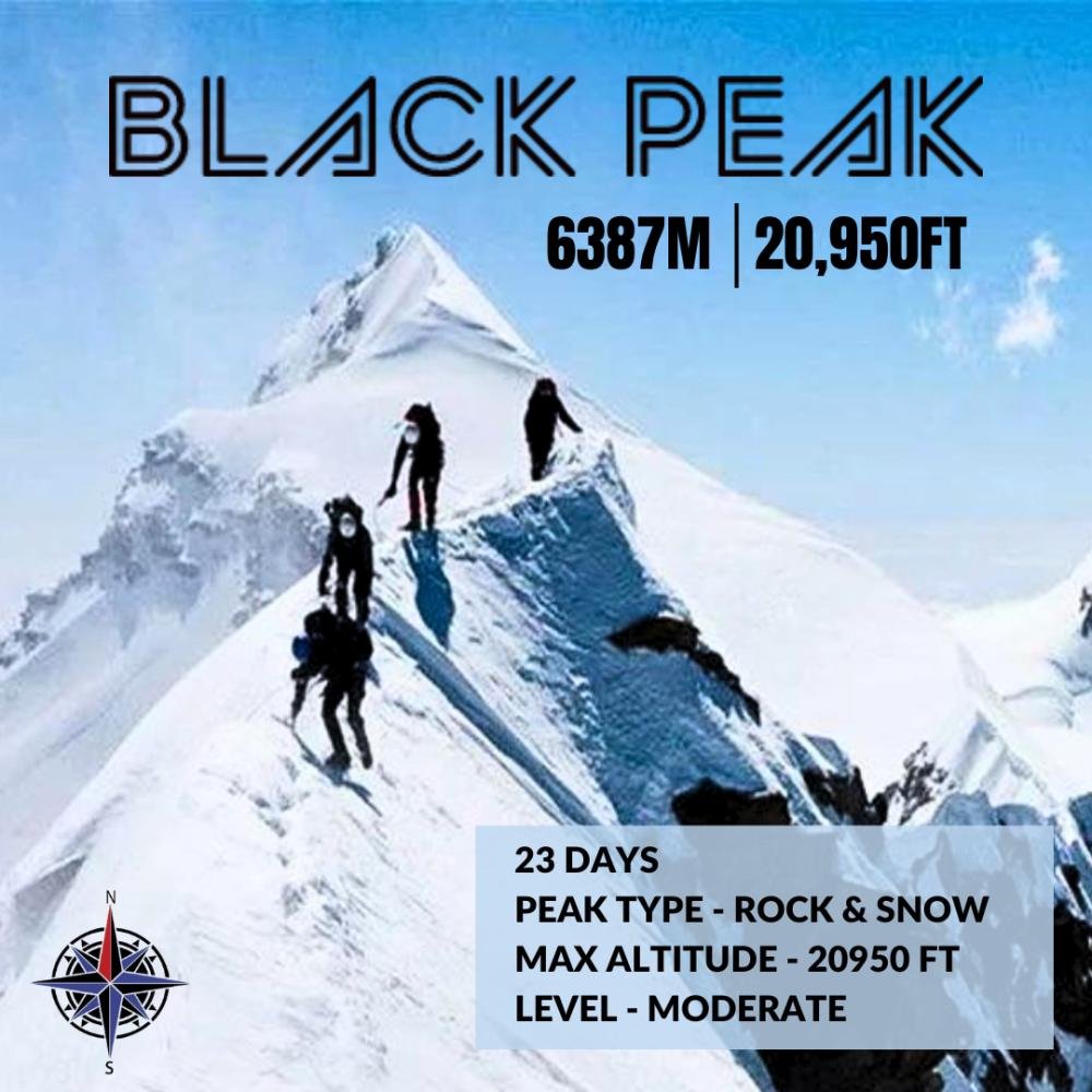
Black Peak

July 30, 2025

Black Peak
Why You Should Go on the Black Peak (Kala Nag) Expedition Incredible Height:Black Peak, also called Kala Nag, rises to an amazing height of 6,387 meters.It is the highest peak in the Bandarpoonch mountain range, which makes it even more special. A True Adventure:Climbing Black Peak is a once-in-a-lifetime experience.Its a real test of courage and strength and gives you a deep sense of achievement. Part of the Bandarpoonch Range:Black Peak is one of the three main mountains in the Bandarpoonch group, which is a well-known mountain range in the Indian Himalayas. Beautiful Natural Surroundings:The route to the peak goes through Govind National Park.This area is full of amazing plants and animals, and the views of the Gangotri region are breathtaking. A Challenging Climb:This trek is not an easy one.Its a technical climb, which means youll cross snowfields with cracks (crevasses), rocky paths, and glaciers and even climb a steep 75-foot-tall ice wall thats almost vertical.Its exciting and toughperfect for adventure lovers! ABOUT BLACK PEAK Black Peak, also known locally as Kala Nag, stands out as one of the most remarkable. Towering at an impressive height of 6,387 meters, summiting this peak is truly a once-in-a-lifetime experience. Interestingly, Black Peak is the highest summit in the entire Bandarpoonch range. This massif includes three major peaks: Bandarpoonch II, also called Saraswati Peak (6,102 m), Bandarpoonch I (6,316 m), and the tallest among themBlack Peak. Taking on the Black Peak Expedition is a tribute to the fearless spirit of human adventure and the desire to overcome some of natures toughest obstacles. The route to the summit winds through the scenic Govind National Park, where youll encounter a wide variety of wildlife and vegetation, as well as the enchanting forests of the Gangotri region. Throughout the journey, youll be treated to views of some of the Garhwal Himalayas' most iconic peaks, such as the Bhagirathi group, Swargarohini, the Bandarpoonch range, and the Gangotri peaks. The breathtaking natural beauty is matched by the sheer excitement of the climb. This high-altitude expedition spans several weeks and takes you through rough, demanding Himalayan terraina dream challenge for serious adventurers. Its a fully technical climb that includes crossing deep crevasses, unstable rocky stretches, icy glaciers, and tackling the heart-pounding 75-foot vertical ice wall with a slope of nearly 70 degrees on the final push to the top. This journey is a true test of your grit and perseverance. Harsh weather, steep climbs, and narrow hanging bridges push both your body and mind to their limits. The Black Peak Expedition isnt for beginnersits designed for experienced mountaineers who possess advanced rock and ice climbing skills and a solid understanding of the mountain's complex terrain. Reaching the summit of Black Peak brings with it an unmatched feeling of triumph. The sweeping views from the top offer a spectacular window into the untouched grandeur of the Himalayas, leaving you with a deep sense of awe, pride, and connection to the natural world. Embark on this unforgettable journey with Oxbow Explore.Ready to take on the challenge?Visit www.oxbowexplore.com or reach out to us at info@oxbowmedia.in to start planning your adventure today!
read more arrow
CLIMBING WITH A CONSCIENCE: LEAVE NO TRACE IN THE INDIAN HIMALAYAS

June 24, 2025

CLIMBING WITH A CONSCIENCE: LEAVE NO TRACE IN THE INDIAN HIMALAYAS
Discover how to practice sustainable mountaineering in India. Learn the Leave No Trace principles and how climbers can protect the fragile Himalayan ecosystem with Oxbow Explore. The Indian Himalayas are more than just mountainsthey are living landscapes shaped by nature, culture, and ancient wisdom. Every summit we chase and trail we tread on has a story, a rhythm, and a balance that deserves respect. At Oxbow Explore, we believe that true adventure includes responsibilityand nothing embodies this more than the principle of Leave No Trace. As mountaineering and trekking become more popular across India, its crucial we protect the very wilderness we seek to explore. Here's how you can climb with a conscience and help preserve the fragile ecosystem of the Indian Himalayas. Why Leave No Trace Matters More in the Indian Himalayas The Himalayas are ecologically sensitive zones, home to rare flora, wildlife, and traditional communities. The rise in unregulated tourism and expeditions has led to Waste accumulation at campsites and trails Glacier degradation due to pollution Disturbance of wildlife corridors Cultural insensitivity in sacred landscapes Without sustainable practices, even a single expedition can leave a scar. That's where the Leave No Trace (LNT) principles become essentialnot just as guidelines but as a way of life. 7 Leave No Trace Principles for Mountaineering in India 1. Plan Ahead and Prepare Research your route, understand local customs, and ensure your team is trained in eco-conscious practices. Carry reusable supplies and minimize packaged goods. 2. Travel and Camp on Durable Surfaces Stick to established trails and designated campsites. Avoid trampling alpine meadows, mossy patches, or cultural sites. 3. Dispose of Waste Properly Pack it in, pack it out. Carry biodegradable bags for human waste, segregate plastic waste, and never bury trash in snow or soil. 4. Leave What You Find Dont pick flowers, collect stones, or touch ancient relics. Let nature and culture remain as they are untouched and undisturbed. 5. Minimize Campfire Impact Avoid lighting fires in high-altitude or forested areas. Use gas stoves for cooking and never leave burnt remains. 6. Respect Wildlife Keep a distance from animals. Dont feed or photograph wildlife aggressively. Use binoculars instead. 7. Be Considerate of Local Communities Greet locals respectfully, follow village customs, and support eco-conscious homestays and guides. Your behaviour reflects on all climbers who come after you. How Oxbow Explore Embeds Sustainability in Every Expedition At Oxbow Explore, we dont just climb peakswe craft purposeful journeys. Heres how we practice what we preach: Certified eco-guides and waste warriors on every expedition Carry-back systems for non-biodegradable waste Partnerships with local communities for trail maintenance Leave No Trace orientation for all participants Carbon-offset planning for longer expeditions From the Siachen Glacier to virgin peaks in Arunachal Pradesh, we ensure every ascent is matched by respect for the land and its people. The Responsibility of the Modern Mountaineer Whether you're summiting a 7000m peak or on a weekend alpine trek, your presence has an impact. Practicing Leave No Trace is not about perfectionit's about awareness, intention, and action. Climbing with a conscience means you leave the mountains better than you found themwith lighter footprints, deeper gratitude, and stories worth telling. Ready to Climb with Purpose? Join us in building a new standard for Indian adventurewhere every expedition is mindful, meaningful, and sustainable. Explore Responsible Expeditions:www.oxbowexplore.com
read more arrow
BEHIND THE SCENES: HOW A MOUNTAINEERING EXPEDITION IS PLANNED IN INDIA

June 16, 2025

BEHIND THE SCENES: HOW A MOUNTAINEERING EXPEDITION IS PLANNED IN INDIA
Ever wondered what goes into planning a mountaineering expedition in India? From permits to porters, here's a detailed look behind the scenes of how expeditions are built step by step. Mountaineering in India is not just a test of enduranceits a deep logistical ballet played out across high altitudes, unpredictable terrain, and shifting weather. While summit photos tell one part of the story, the real adventure often starts long before the first boot hits the trail. At Oxbow Explore, where we curate concept-led expeditions across Indias frontier landscapes, we know what it takes to bring a vision to life at 20,000 feet. Here's a behind-the-scenes look at how a mountaineering expedition is planned in India, from ideation to execution. 1. The Big Idea: Why This Peak? Every expedition starts with a purpose. It could be: A first ascent of a virgin peak A tribute expedition with a message (e.g., honouring war heroes or empowering women) A technical challenge for elite climbers A training climb for aspiring mountaineers Route selection, accessibility, symbolic value, and terrain difficulty all influence this first step. Often, research includes satellite maps, past expedition reports, and discussions with local villagers and guides. 2. Permissions Paperwork Mountaineering in India, especially near border areas like Sikkim, Arunachal, and Ladakh, requires multiple clearances: Peak booking through the Indian Mountaineering Foundation (IMF) Inner Line Permits (ILPs) for restricted regions Defense or ITBP permissions in sensitive zones Environmental forest department clearances This step can take weeks or even months and requires accurate documentation, expedition objectives, team credentials, and detailed route plans. 3. Team Selection Training An expedition is only as strong as its team. Planning involves Selecting experienced climbers or training newcomers Assigning roles: lead climber, support climbers, logistics manager, medical-in-charge Pre-expedition conditioning, especially for high-altitude endurance First-aid and self-rescue drills At Oxbow Explore, we ensure each participant is aligned not just technically, but also with the ethos and narrative of the expedition. 4. Logistics: The Invisible Engine From Delhi to the base camp, every step is coordinated meticulously: Tents, sleeping bags, ropes, crampons, cooking equipment Local porters, high-altitude guides, cooks, yaks/mules Food planning (think high-carb, lightweight, altitude-friendly meals) Emergency gear: oxygen cylinders, stretchers, satellite phones Vehicle support till road ends For remote peaks, advance recce teams are sometimes sent to check glacier conditions or trail accessibility. 5. Setting Up Base Camp Acclimatization Once at the mountains base, the next few days go into Establishing Base Camp (BC) with communications, kitchen, and shelter Acclimatization walks to higher altitudes Setting up Advance Base Camp (ABC) and higher camps depending on the peak's height and route Ferrying equipment and supplies between camps This phase can last 715 days, depending on weather and team performance. 6. Weather Windows Summit Strategy The most unpredictable factorthe weatheris monitored daily. Decisions are made based on: Satellite weather updates Wind speed at summit altitude Snowfall forecasts and avalanche risk Once a weather window opens, the team makes its summit pushusually a 1218 hour effort starting in the dark. Timing, pace, hydration, and team coordination are critical. 7. The Summitand the Descent While reaching the summit is exhilarating, getting back safely is the true success. Most accidents occur during descent, so the strategy includes Coordinated descent in small teams Constant communication with base Recovery at lower camps 8. Post-Expedition Cleanup Impact We emphasize Leave No Trace principles: All waste, especially non-biodegradable, is packed out Campsites are cleaned Local porters and guides are compensated fairly In addition, many of our expeditions include community engagement, local hiring, or skill-building initiatives in the regions we explore. Why It Matters Mountaineering in India is a powerful way to connect with the land, its people, and ones own inner resilience. But what the world sees as a few photos on a summit often comes from months of meticulous planning, coordination, and local partnership. At Oxbow Explore, we take pride in not just climbing mountains but crafting stories of purpose, participation, and positive impact. Are you ready to be a part of a mountain story that matters? Visit: www.oxbowexplore.comGet in Touch: Plan your next expedition with our expert team
read more arrow
10 LESSER-KNOWN PEAKS IN INDIA FOR SERIOUS MOUNTAINEER

June 9, 2025

10 LESSER-KNOWN PEAKS IN INDIA FOR SERIOUS MOUNTAINEER
Indias Himalayan expanse is home to many iconic summits like Reo Purgyil, Kamet, and Kanchenjunga. But beyond the spotlight, there lies a world oflesser-known peaks raw, remote, and thrillingly untamed. For serious mountaineers who seek solitude, technical routes, and unclimbed or rarely attempted mountains, these hidden giants offer the ultimate test of skill and spirit. At Oxbow Explore, we specialize in concept-driven expeditions, exploring new routes, virgin summits, and borderland climbs. Heres our curated list of 10 lesser-known peaks in India every seasoned mountaineer should put on their radar. 1. Mt. Jongsong (7462 m)Sikkim Region: Zemu Glacier, Sikkim Why Its Special: Indias third-highest peak and among the least attempted in this altitude bracket. Located on the Indo-Nepal border with challenging access and extreme conditions. For Whom: Veteran climbers with high-altitude experience. 2. Mt. Rimo I (7385 m)Karakoram, Ladakh Region: Rimo Muztagh, Eastern Karakoram Why Its Special: One of Indias most secluded and militarised zones. First climbed by an Indo-British expedition in 1988. A technical and logistical challenge. For Whom: High-altitude climbers with permission for sensitive border zones. 3. Mt. Chombu (6362 m)North Sikkim Region: Near Thangu, North Sikkim Why Its Special: Still unclimbed as of recent records. A sacred peak and subject to strict access control, Chombu is remote and technically steep. For Whom: Exploratory teams with Alpine experience and permits. 4. Mt. Suj Tilla (6373 m)Kumaon, Uttarakhand Region: Johar Valley Why Its Special: Known as the Peak of Needles, its infamous for knife-edge ridges and sharp cornices. Very few successful ascents. For Whom: Climbers seeking a thrilling, technical route in the lesser-traveled Kumaon Himalayas. 5. Mt. Chaukhamba I (7138 m)Garhwal, Uttarakhand Region: Gangotri Glacier Why Its Special: Often overshadowed by Shivling and Bhagirathi peaks, Chaukhamba is a majestic, challenging climb with complex snow and ice slopes. For Whom: Seasoned mountaineers whove summited 6000m+ peaks. 6. Mt. Khangchengyao (6889 m)Sikkim Region: North Sikkim Why Its Special: Considered sacred by locals, access is highly regulated. Steep ridgelines and glaciated approaches make it a serious climb. For Whom: Climbers with diplomatic or special expedition permissions. 7. Mt. Gya (6794 m)Himachal PradeshLadakh Border Region: SpitiLadakh Border Why Its Special: Often referred to as the highest peak in Himachal, Gya offers a mix of rock, snow, and remote expedition-style climbing. For Whom: Experienced expeditioners looking for solitude and geology-rich terrain. 8. Mt. Menthosa (6443 m)Lahaul, Himachal Pradesh Region: Lahaul Valley Why Its Special: One of the highest peaks in Himachal Pradesh and rarely attempted due to poor documentation and tough terrain. For Whom: Technical climbers and those looking for alpine-style challenges. 9. Mt. Khangla Tarbo I II (6270m 6220m) Ladakh Region: Zanskar Why Its Special: Twin peaks with unclimbed faces and incredible potential for first ascents. For Whom: Mountaineers looking to make their mark on unclimbed or rarely summited peaks. 10. Mt. Gorichen (6488 m)Arunachal Pradesh Region: Tawang Why Its Special: One of the easternmost high-altitude peaks in India. Rugged, mysterious, and culturally significant. Oxbow Explore is actively working to open new routes and build expeditions here. For Whom: Explorers interested in borderland expeditions with cultural depth. Climbing Beyond the Popular India's high-altitude potential is vast and still largely untapped. These lesser-known peaks challenge not just your mountaineering skill but also your ability to plan, adapt, and lead. They're not commercial climbs. They're experiences that demand commitment, respect for nature, and a spirit of exploration. At Oxbow Explore, were working to bring these hidden summits to the forefront with safety, purpose, and impact-led travel. Our expeditions combine local engagement, environmental stewardship, and cutting-edge logistics, opening up new frontiers for Indian and international mountaineers alike. Planning to Climb One of These Peaks? ✅ Permit Assistance✅ Custom Expedition Planning✅ Technical Support Safety✅ Community Engagement Opportunities #HiddenPeaksIndia #OxbowExplore #ClimbWithPurpose #HimalayanExpeditions #IndianMountaineering #OffbeatClimbs
read more arrow
MOUNTAINEERING GRADES DECODED: UNDERSTANDING DIFFICULTY LEVELS IN INDIAN PEAKS

May 27, 2025

MOUNTAINEERING GRADES DECODED: UNDERSTANDING DIFFICULTY LEVELS IN INDIAN PEAKS
Curious about mountaineering difficulty levels in India? Learn how Indian peaks are graded, what each level means, and which expeditions suit your skill set. Mountaineering in India is a breathtaking blend of adventure, challenge, and self-discovery. With the mighty Himalayas stretching across the northern frontiers, India is home to some of the most iconic and unexplored peaks in the world. But before tying your boots and picking up the ice axe, its essential to understand how mountaineering grades work and how they affect your journey.At Oxbow Explore, where we specialise in concept-led expeditions in Indias high-altitude terrains, we believe that informed adventurers make safer, more rewarding climbs. This guide decodes the difficulty levels of Indian peaks and helps you find the right expedition that matches your experience and ambition.What Are Mountaineering Grades?Mountaineering grades are used globally to denote the technical difficulty, physical endurance, and environmental challenges involved in a climb. In India, grading loosely follows international standards, often influenced by Alpine or UIAA (Union Internationale des Associations d'Alpinisme) systems, but customized by institutes like NIM, HMI, and NIMAS based on Indian terrain conditions.Understanding the Indian Mountaineering Grading SystemWhile there's no single national grading framework, peaks in India are generally classified into three primary categories:1. Easy (Grade I) Altitude: Up to 5000m Terrain: Gentle slopes, snowfields, minimal glacier navigation Technical Skills: Basic mountaineering or trekking experience Examples: Kedarkantha (3810m), Friendship Peak (5289m), Pangarchulla (4593m) Best For: Beginners or trekkers transitioning into basic mountaineeringRecommended Training: Basic Mountaineering Course (BMC)2. Moderate (Grade II) Altitude: 5000m 6000m Terrain: Mixed terrain including snow, ice, rock, and crevasses Technical Skills: Use of ropes, crampons, ice axe, crevasse rescue Examples: Mount Deo Tibba (6001m), Mount Mentok Kangri (6250m), Mt. Yunam (6111m) Best For: Climbers with previous high-altitude trekking or BMC experienceRecommended Training: Advanced Mountaineering Course (AMC) 3. Difficult (Grade III Above) Altitude: 6000m+ Terrain: Steep ice walls, knife-edge ridges, avalanche zones, extreme weather Technical Skills: Advanced alpine techniques, self-rescue, high-altitude survival Examples: Mount Satopanth (7075m), Mount Bhagirathi III (6454m), Mount Shivling (6543m) Best For: Experienced climbers with multiple expeditions and certified trainingRecommended: Expedition experience, AMC, and specialised alpine rescue training Special Considerations in Indian ConditionsIndias peaks are often more remote than those in other mountaineering hubs like the Alps. Here are unique factors that can affect grading: Weather variability in regions like Sikkim and Arunachal Pradesh Lack of established base infrastructure in virgin peaks Military permissions and border sensitivities Limited rescue accessibility in isolated Himalayan pocketsThats why Oxbow Explore focuses not just on difficulty, but on expedition planning, logistics, safety, and purpose-led experiences. Choosing the Right Expedition for YouHeres a quick checklist to help you assess which grade suits you:Experience Level Suggested Grade Expedition TypeFirst-time Trekker Grade I Entry-level Peak TreksBMC Certified Grade II Introductory ClimbsAMC + Prior Summit Grade III Above Technical Expeditions Mountaineering is not just about reaching summits its about pushing limits, understanding the terrain, and respecting the mountains. Whether youre aiming for your first 5000m climb or preparing for a technical summit above 7000m, understanding the grading system is your first step toward a meaningful ascent.At Oxbow Explore, we curate expeditions that are not only safe and well-supported but also rooted in community engagement, cultural storytelling, and environmental responsibility. Whether its a women-led summit, borderland exploration, or first ascent of a virgin peak, our journeys are designed for more than the summit.
read more arrow
How to Prepare for Your First Mountaineering Expedition in India

May 9, 2025

How to Prepare for Your First Mountaineering Expedition in India
Indias vast and rugged mountain ranges offer some of the most breathtaking mountaineering experiences in the world. From the icy slopes of Stok Kangri to the technical challenges of Mt. Satopanth, the country is a paradise for aspiring climbers. However, stepping into the world of mountaineering isnt just about reaching the summitit requires rigorous physical training, the right gear, and strong mental resilience. If you're planning your first mountaineering expedition in India, heres a comprehensive guide to ensure you're well-prepared for the adventure ahead. 1. Physical Fitness: Building Strength and Endurance Mountaineering is one of the most physically demanding activities, requiring a mix of strength, endurance, and agility. A solid fitness regimen will prepare your body to handle long ascents, carry heavy loads, and adjust to low oxygen levels at high altitudes. Key Areas of Fitness to Focus On: a) Cardiovascular Endurance Start with long-distance running, cycling, or swimming at least 4-5 days a week. Incorporate stair climbing with a weighted backpack to simulate trekking conditions. Gradually increase your training elevation by hiking on hilly terrain. b) Leg and Core Strength Perform squats, lunges, step-ups, and deadlifts to build leg power. Strengthen your core with planks, Russian twists, and hanging leg raisesa strong core improves balance and stability. c) Flexibility Mobility Practice yoga and dynamic stretching to enhance flexibility and prevent injuries. Focus on ankle, hip, and shoulder mobilitycritical for rough terrain and carrying a heavy backpack. 2. Acclimatization: Preparing for High Altitude One of the biggest challenges in mountaineering is altitude sickness due to reduced oxygen levels above 3,000 meters (9,800 ft). Proper acclimatization is crucial for a safe climb. How to Acclimatize Effectively: ✅ Train at higher altitudes before your expeditiontry treks in Himachal Pradesh, Uttarakhand, or Ladakh.✅ Increase your altitude gradually and follow the climb high, sleep low principle.✅ Stay hydrated and avoid alcohol smoking, as they can worsen altitude sickness.✅ Listen to your bodyheadaches, dizziness, and nausea are early signs of altitude sickness. If symptoms worsen, descend immediately. 3. Gear Checklist: Essentials for a Successful Climb Having the right gear can make or break your expedition. Unlike trekking, mountaineering involves technical equipment and protective layers designed for harsh conditions. Essential Mountaineering Gear: Clothing (Layering System): Base LayerMoisture-wicking thermal wear to keep you dry.Mid LayerFleece or down jacket for insulation.Outer LayerWaterproof windproof jacket and pants (Gore-Tex recommended). Footwear: High-ankle mountaineering boots (ensure they're waterproof and compatible with crampons).Thermal socks to prevent frostbite and blisters. Climbing Gear: Ice axeEssential for snow-covered slopes.CramponsMetal spikes attached to boots for traction on ice.Harness, helmet, and carabinersmandatoryfor glacier and technical climbs.Ropes and ascendersusedfor fixed-line climbing. Accessories Safety Gear: Backpack (50-70 L)Spaciousenough to carry gear but not overly heavy.UV-protected sunglasses sunscreentocombat snow blindness and sunburn.Insulated gloves gaitersKeep your hands and feet warm and dry.First Aid KitInclude Diamox (for altitude sickness), painkillers, bandages, and personal medications.Sleeping Bag (-10C to -20C rated)Essentialfor high-altitude camps. 4. Mental Toughness: Conquering the Psychological Barriers Mountaineering is as much a mental challenge as it is a physical one. Harsh weather, fatigue, and isolation can test your patience and determination. Mental preparedness is key to overcoming these hurdles. How to Build Mental Strength: Meditation VisualizationPicture yourself reaching the summit, pushing through exhaustion.Train in tough conditionsexposeyourself to cold, fatigue, and discomfort in training.Develop a Never Quit AttitudeSet small goals on the mountain (reach the next ridge, climb another 100 meters). Most importantly, stay positive and adaptable. The mountain decides your fate, and being mentally prepared to change plans, turn back if needed, and make rational decisions under stress is crucial. 5. Choosing the Right Peak for Your First Expedition If you're new to mountaineering, it's best to start with a non-technical peak before progressing to challenging climbs. Beginner-Friendly Peaks in India: ✅ Stok Kangri (6,153m,High-altitude but non-technical.✅ Kang Yatse II (6,250m, Ladakh)A great step up from trekking.✅ Friendship Peak (5,289m, Himachal Pradesh)Perfect introduction to glacier trekking.✅ Black Peak (6,387m, Uttarakhand)Ideal for those ready to transition into technical climbing. Once you've built experience and confidence, you can aim for technical peaks like Mt. Satopanth, Nun-Kun, or CB13. 6. Training Expeditions: Get Real-World Experience Before committing to a high-altitude mountaineering expedition, its beneficial to gain experience through:Himalayan treks (like Roopkund, Goecha La, or Kedarkantha) to test your endurance.Basic Mountaineering Courses (BMC) from NIM, NIMAS, HMI, or ABVIMAS to learn technical skills.Short ice climbing or glacier training programs in Ladakh or Uttarakhand. Embrace the Challenge Mountaineering is not just about reaching the summitits about learning, adapting, and growing stronger with every climb. Preparing well for your first expedition ensures that you enjoy the experience safely while respecting the mountains and their challenges. The Indian Himalayas offer some of the best mountaineering opportunities in the world. If you train hard, gear up right, and stay mentally strong, your first mountaineering expedition will be the start of an incredible lifelong adventure. So, are you ready to take your first step into the world of mountaineering?
read more arrow
Your Ultimate Guide To Mountaineering In India

February 24, 2025

Your Ultimate Guide To Mountaineering In India
MOUNTAINEERING Mountain Climbing in India: Peaks, Ranges, and Difficulty Levels India, home to some of the most magnificent mountain ranges in the world, offers climbers an extensive variety of peaks to conquer. From the formidable Himalayan giants to the lesser-known yet challenging peaks of the Western and Eastern Ghats, India's diverse geography presents opportunities for both amateur trekkers and seasoned mountaineers. Major Mountain Ranges for Climbing 1. The Himalayas The Himalayas, the highest mountain range in the world, dominate northern India and boast some of the most challenging and peaks. Mount Kangchenjunga (8,586 m, Sikkim)thethird highest mountain in the world, requiring advanced mountaineering skills. Nanda Devi (7,816 m, Uttarakhand):Indias second-highest peak, known for its technical difficulties. Kamet (7,756 m, Uttarakhand):A challenging climb due to its remote location. Satopanth (7,075 m, Uttarakhand): A less attempted but rewarding peak. Stok Kangri (6,153 m, Ladakh): Popularamong trekkers transitioning to mountaineering. 2. The Karakoram Range Located in the northernmost region, this range is home to some of the most technically demanding climbs. Saltoro Kangri (7,742 m, Siachen region):A peak rarely climbed due to its location near the Siachen Glacier. Saser Kangri (7,672 m, Ladakh): a difficultpeak with extreme weather conditions. 3. The Western Ghats Although not as high as the Himalayas, the Western Ghats offer rugged terrain and significant challenges. Anamudi (2,695 m, Kerala): The highest peak in southern India, ideal for moderate trekkers. Kalsubai (1,646 m, Maharashtra):A popular trekking destination with steep ascents. 4. The Eastern Ghats Lesser explored but still significant, the Eastern Ghats feature some exciting climbs. Arma Konda (1,680 m, Andhra Pradesh):The highest peak in the Eastern Ghats. Mahendragiri (1,501 m, Odisha):A sacred peak with moderate trekking challenges. 5. The Satpura and Vindhya Ranges These central Indian ranges offer trekking opportunities in a different geographical setting. Dhoopgarh (1,350 m, Madhya Pradesh): Thehighest peak in the Satpura range. Kalumar Peak (752 m, Madhya Pradesh):Located in the Vindhyas, offering moderate difficulty. Difficulty Grading for Climbers Mountaineering challenges vary across different peaks, broadly categorized into three difficulty levels: 1. Easy (Altitude below 4,000 m) Best suited for beginners. It requires basic fitness and minimal technical skills. Examples: Kalsubai, Mullayanagiri, and Chembra Peak. 2. Moderate (4,000 m 6,000 m) Requires prior trekking experience. May involve glacier walking, technical rock climbing, and exposure to high altitudes. Examples: Stok Kangri, Kang Yatse II, Friendship Peak. 3. Difficult (Above 6,000 m) Suitable for experienced mountaineers. Demands technical expertise, high-altitude acclimatization, and endurance. Examples: Kangchenjunga, Nanda Devi, Kamet. Permits and Regulations Climbing in India often requires obtaining permits, depending on the region. The Indian Mountaineering Foundation (IMF) oversees most climbing expeditions in the Himalayas. Special permissions may be required for border-sensitive areas like Karakoram and Arunachal Pradesh. Local forest and environmental clearances are necessary for Western Ghats and other ecological zones. Best Time for Mountaineering in India Himalayas: May-June and September-October. Western Eastern Ghats: October-March. Karakoram Ladakh: July-September.
read more arrow
arrow
Itineraries Downloads